Priority Landscapes
Priority Landscapes Summary
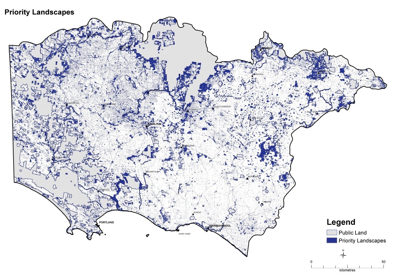
Prioritisation of landscapes for climate change mitigation action takes into account the protection, enhancement and carbon sequestration potential of both terrestrial vegetation and wetlands. Figure 33 shows the areas of dense or connecting high value ecosystems and high carbon sequestration potential.
The map highlights several priority areas including:
-
the areas connecting the Glenelg River through Dergholm to the north of the catchment andeast to the Grampians National Park and further east to the Pyrenees Ranges
-
river systems and associated floodplains
-
wetlands and wetland complexes
- coastal areas including estuaries and coastal saltmarsh habitats.
The areas not identified as priority landscapes are mostly agricultural areas and generally align with the Victorian Volcanic Plains. Projects that include wetland protection and enhancement as well as the creation of shelterbelts and the protection of paddock trees would be encouraged in these areas.