Priority Areas
Priority Areas
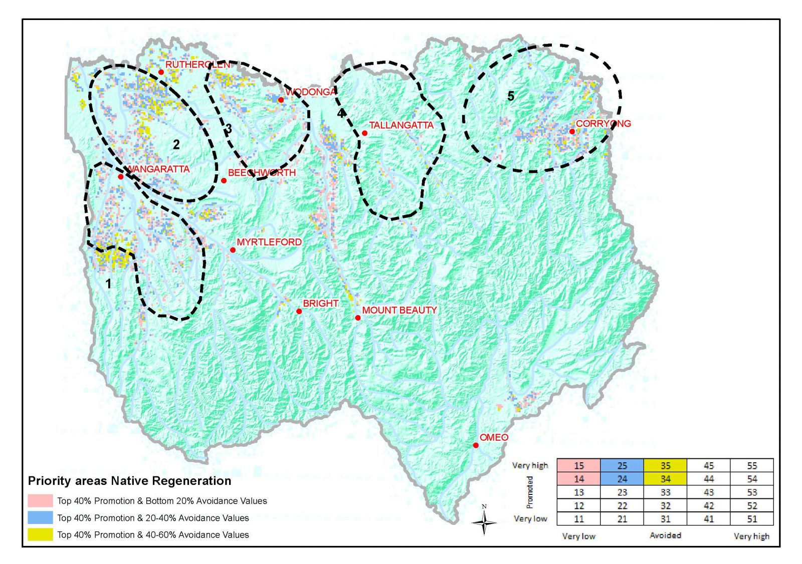
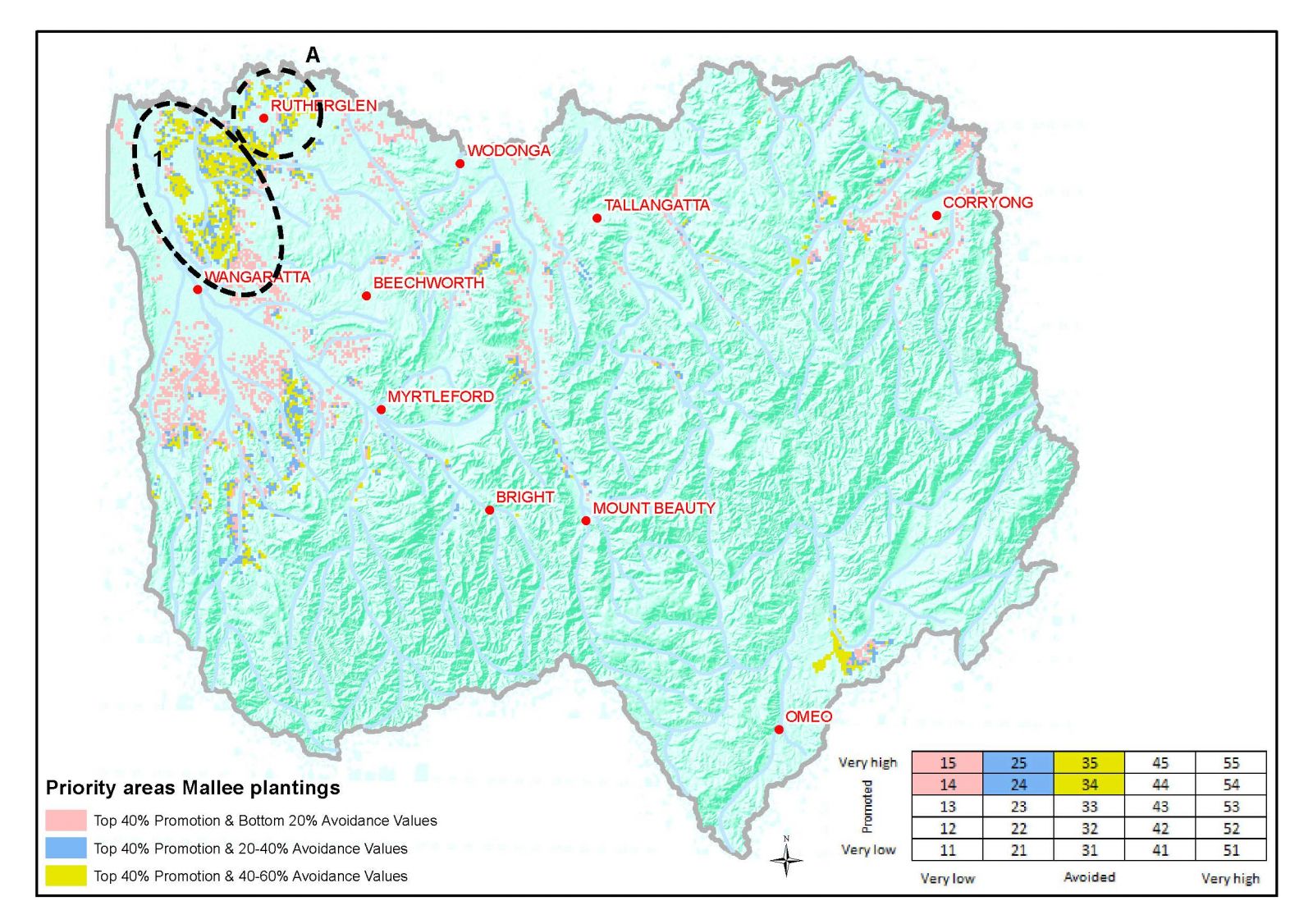
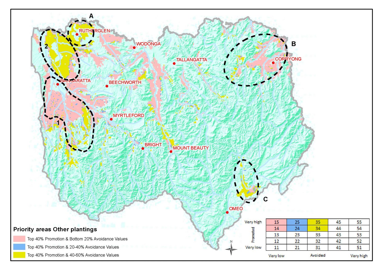
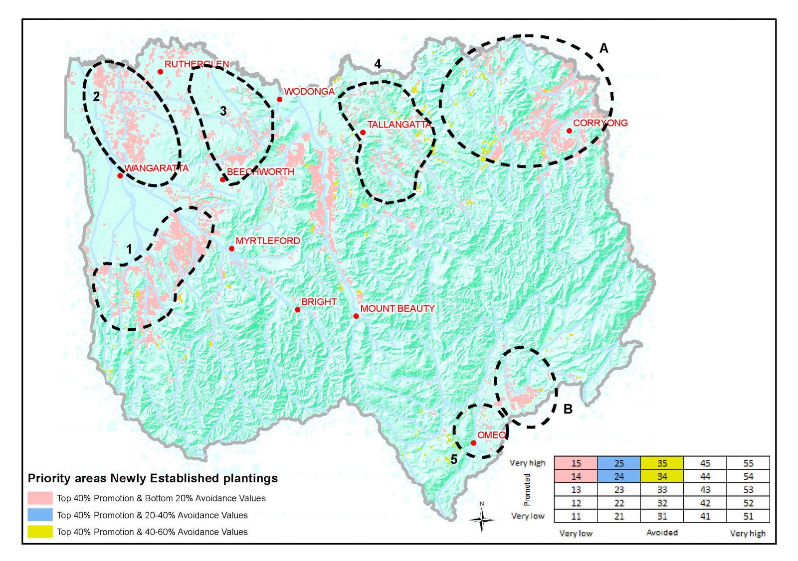
A Spatial Assessment Tool (SAT) was developed to help identify areas across the region that are vulnerable to climate change and which of those should be a focus for adaptation management actions. The SAT incorporates local knowledge and data sets and enables development of scenarios of climate change impact. Data required for the SAT is housed in the SAT Data Library. The Spatial Assessment Tool (SAT) also identifies potential priority areas for biodiverse and other sequestration based forms of carbon farming.
Three main types of carbon sequestration opportunity are applicable to the North East. They include:
-
Environmental plantings, including newly established and natural regeneration. This includes the establishment of new plantings of locally indigenous native species on land that has not recently supported native forest or woodlands. These plantings may be established by planting of tube stock, direct seeding, or as a result of management actions which encourage natural regeneration.
-
Non-environmental plantings: establishment of new forests or woodlands on land that has not recently supported forest cover using species that are not locally indigenous. This includes the establishment of permanent mallee eucalypts in blocks or belts on land receiving less than 600mm average annual rainfall and not recently supporting native forest cover.
-
Native forest protection: the avoidance of legally permitted clearing of native forests on private land and their on-going management as protected forests. Carbon stocks in national parks, other conservation reserves, and land not subjected to harvesting regimes are excluded from generating carbon credits.
The Spatial Assessment Tool (SAT) identifies priority areas for environmental and non-environmental plantings using eligibility criteria from the ERF and criteria sets that were used to either “promote†locations as being suitable for the specific form of carbon farming or to “avoid†locations that would not be appropriate for particular forms of carbon farming. Priority areas were not identified for native forest protection opportunities due to the lack of information on (and likely small extent of) areas where landowners have existing legal entitlement to clear.
Detailed information about the development of the SAT and maps illustrating priority areas can be found in “NRM Planning for Climate Change, Goulburn Broken and North East Catchment Management Authorities, Jacobs 2014â€.