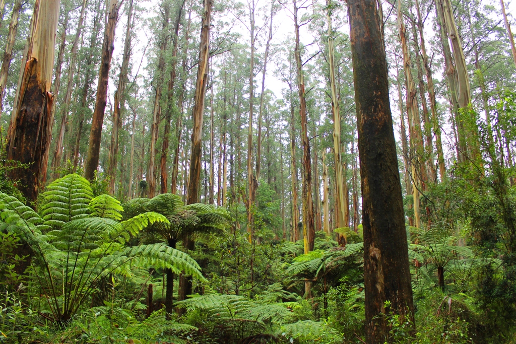
Native Vegetation
Approximately 500,000 hectares of native vegetation remain in the Port Phillip and Western Port region. It covers about 39% of the region’s land area.
Climate change is expected to amplify existing pressures on native vegetation by exposing it to:
- Increased long-term average temperatures.
- Increased hot-day temperatures.
- Lower and more erratic rainfall.
- Higher evaporation.
- Lower soil moisture.
- Increased fire-weather frequency and intensity.
- Sea level rise.
A drier, warmer climate is expected to drive decline in many existing vegetation communities.
Drought tolerant native species may replace existing vegetation in some areas and dominance by drought tolerant weeds and exotics is a real possibility. How changed vegetation will support the current diversity of native animals is unknown.
Where dispersal is possible in continuous vegetation communities, climate change could drive distribution shifts by native vegetation communities. Dispersal could be at the expense of other resident species.
Communities could be made locally extinct where dispersal is not possible.
Vegetation dispersal will be governed by complex and uncertain factors; the rate and intensity of climate change, soils, topography, aspect, the presence of supporting animals and microorganisms.
Existing vegetation could be replaced by drought-tolerant native species or drought-tolerant weeds and exotics.
How and if changed vegetation could support the current diversity of native animals is unknown.
Coastal vegetation on Port Phillip Bay and Western Port is vulnerable to sea level rise. Shrinking coastal margins will make protecting coastal vegetation difficult, particularly where housing, roads and other developments compete for coastal land.
Objectives and Priorities
For native vegetation, the objective is to retain high quality native vegetation in the region providing habitat for native species and making significant contributions to the overall environmental health and resilience of the region. The priorities are to:
- permanently maintain the extent of numerous large and/or important patches of native vegetation and ensure they are managed primarily for conservation purposes; and
- retain the collective quantity/quality of the other native vegetation across the landscape.
For revegetation and carbon plantings, the objective is to achieve benefits for biodiversity and land management whilst also sequestering and storing carbon in the landscape. The priorities are to:
- focus major revegetation programs on particular areas that offer opportunities for major new 'Nature Links' to improve habitat extent, connectivity and resilience;
- focus carbon planting programs on areas with high carbon sequestration potential that also contribute to the development of major new 'Nature Links' and avoid undesirable outcomes; and
- protect existing significant stores of carbon held in coastal/marine soils and vegetation (‘blue carbon’) including in the saltmarsh and mangrove areas along the western shoreline of Port Phillip Bay and the coastal areas of Western Port.
Map: Native vegetation sensitive to climate change
Description:
This static map layer below depicts native vegetation that was assigned a ‘very high’ or ‘catastrophic’ rating for its likely sensitivity to climate change (changes in annual rainfall and/or changes to maximum temperatures over the spring and summer period) under the Representative Concentration Pathway (RCP) 4.5 scenario. Sensitive vegetation is likely to be the first affected by climate change. To view specific points of interest, please click on the map tab which displays an interactive map of native vegetation sensitive to climate change.
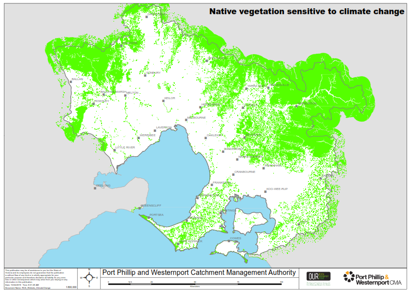
RCP 4.5 is considered to be a moderate scenario of future carbon emissions. Under the RCP 4.5 scenario, it is predicted that annual average rainfall could reduce by 16-34mm below the 1986-2005 average and maximum summer temperature could increase by 2-2.9 degrees above the 1986-2005 average. However, actual future changes could be smaller or larger depending on the actual effects of rising atmospheric carbon dioxide and the success of global carbon dioxide mitigation.
Sources:
The map layer was derived from Spatial Vision, 2014, NRM Planning for Climate Change, Final Project Report 1 - Impact and Vulnerability Assessment Process and Spatial Outputs, Prepared for Victorian Catchment Management Authorities (on behalf of seven CMAs).
Climate change pressures on native vegetation information was derived from Dunlop, M, Parris, H, Ryan, P, Kroon, F, 2013, Climate-ready conservation objectives: a scoping study, National Climate Change Adaptation Facility, Gold Coast, Australia.
Please visit the Port Phillip & Westernport Regional Catchment Strategy for more information about native vegetation in this region.